![](/images/other/stat-length.png)
![Trail Walking Mont Lozère et Goulet - #5 GR70 Chasseradès - Le Bleymard - Photo](https://media.geolcdn.com/t/1900/400/ext.pjpeg?maxdim=2&url=https%3A%2F%2Fstatic1.geolcdn.com%2Fsiteimages%2Fupload%2Ffiles%2F1553511878bg_sport_marche.png)
#5 GR70 Chasseradès - Le Bleymard
magalette
User
![Length](/images/other/stat-length.png)
Length
19.6 km
![Max alt](https://static1.geolcdn.com/siteimages/upload/files/1508320355ic_sort_altitude_max_24dp.png)
Max alt
1415 m
![Uphill gradient](https://static1.geolcdn.com/siteimages/upload/files/1508320355ic_sort_den_pos_24dp.png)
Uphill gradient
537 m
![Km-Effort](/images/other/stat-length.png)
Km-Effort
27 km
![Min alt](https://static1.geolcdn.com/siteimages/upload/files/1508320355ic_sort_altitude_min_24dp.png)
Min alt
1071 m
![Downhill gradient](https://static1.geolcdn.com/siteimages/upload/files/1508320355ic_sort_den_neg_24dp.png)
Downhill gradient
638 m
![Boucle](https://static1.geolcdn.com/siteimages/upload/files/16400158638029165_repeat_loop_refresh_sync_direction_icon.png)
Boucle
No
Creation date :
2014-12-10 00:00:00.0
Updated on :
2014-12-10 00:00:00.0
![Walking](https://static1.geolcdn.com/sitytour/trail-icons/101.png)
5h41
Difficulty : Medium
![Scan this QR Code to open this trail in the SityTrail application](https://capi.geolives.com/qq0zvz2zws4bq2lad0pu/sitytour/trails/159657/qr.png?size=200)
FREE GPS app for hiking
About
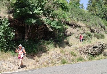
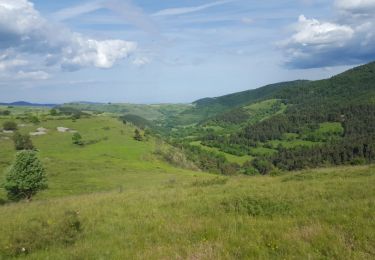
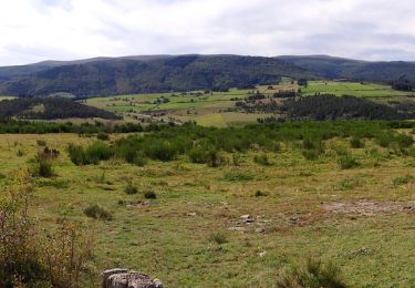
Trail Walking of 19.6 km to be discovered at Occitania, Lozère, Mont Lozère et Goulet. This trail is proposed by magalette.
Description
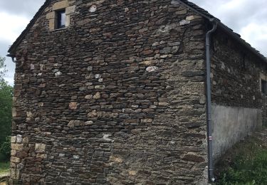
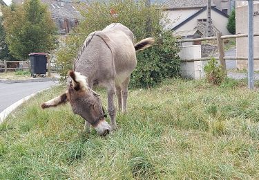
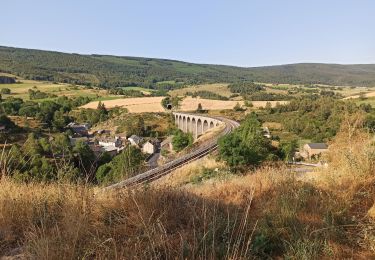
Notre cinquième étape sur les traces de Stevenson entre Chasseradès et Le Bleymard. Nous quittons le Gévaudan pour aborder le mont Lozère.
Positioning
Country:
France
Region :
Occitania
Department/Province :
Lozère
Municipality :
Mont Lozère et Goulet
Location:
Unknown
Start:(Dec)
Start:(UTM)
566277 ; 4934004 (31T) N.
Comments
Trails nearby
![Trail Walking Mont Lozère et Goulet - Stevenson étape 7 - Photo](https://media.geolcdn.com/t/375/260/ca5e79f2-b988-472d-b1a4-865ced3314e1.jpg&format=jpg&maxdim=2)
![Walking Walking](https://static1.geolcdn.com/sitytour/trail-icons/101.png)
Stevenson étape 7
Walking
Difficult
Mont Lozère et Goulet,
Occitania,
Lozère,
France
![](/images/other/stat-length.png)
20 km | 28 km-effort
4h 57min
![](https://static1.geolcdn.com/siteimages/upload/files/16400158638029165_repeat_loop_refresh_sync_direction_icon.png)
No
![Trail Walking Mont Lozère et Goulet - Stevenson Chasseradès - Le Bleymard - Photo](https://media.geolcdn.com/t/375/260/084f4a90-f605-49e0-8cc1-95e8aee0296f.jpg&format=jpg&maxdim=2)
![Walking Walking](https://static1.geolcdn.com/sitytour/trail-icons/101.png)
Stevenson Chasseradès - Le Bleymard
Walking
Very difficult
Mont Lozère et Goulet,
Occitania,
Lozère,
France
![](/images/other/stat-length.png)
21 km | 29 km-effort
5h 4min
![](https://static1.geolcdn.com/siteimages/upload/files/16400158638029165_repeat_loop_refresh_sync_direction_icon.png)
No
![Trail Walking Mont Lozère et Goulet - le Bleymard - Photo](https://media.geolcdn.com/t/375/260/a7e52d95-c918-4024-aa49-8bd4f60cbf65.jpg&format=jpg&maxdim=2)
![Walking Walking](https://static1.geolcdn.com/sitytour/trail-icons/101.png)
le Bleymard
Walking
Very difficult
Mont Lozère et Goulet,
Occitania,
Lozère,
France
![](/images/other/stat-length.png)
17.3 km | 25 km-effort
5h 14min
![](https://static1.geolcdn.com/siteimages/upload/files/16400158638029165_repeat_loop_refresh_sync_direction_icon.png)
No
![Trail Walking Mont Lozère et Goulet - Chasserades Bleymard - Photo](https://media.geolcdn.com/t/375/260/116a16c1-813e-45da-b910-05ff52927fe4.jpg&format=jpg&maxdim=2)
![Walking Walking](https://static1.geolcdn.com/sitytour/trail-icons/101.png)
Chasserades Bleymard
Walking
Difficult
Mont Lozère et Goulet,
Occitania,
Lozère,
France
![](/images/other/stat-length.png)
20 km | 28 km-effort
6h 57min
![](https://static1.geolcdn.com/siteimages/upload/files/16400158638029165_repeat_loop_refresh_sync_direction_icon.png)
No
![Trail Walking Mont Lozère et Goulet - arsel chasserades au bleymard - Photo](https://media.geolcdn.com/t/375/260/93179cba-083a-4533-8ddb-80481acfe8eb.jpg&format=jpg&maxdim=2)
![Walking Walking](https://static1.geolcdn.com/sitytour/trail-icons/101.png)
arsel chasserades au bleymard
Walking
Very easy
Mont Lozère et Goulet,
Occitania,
Lozère,
France
![](/images/other/stat-length.png)
14.1 km | 21 km-effort
6h 14min
![](https://static1.geolcdn.com/siteimages/upload/files/16400158638029165_repeat_loop_refresh_sync_direction_icon.png)
No
![Trail Mountain bike Mont Lozère et Goulet - Chasserades Finiels 2020 - Photo](https://media.geolcdn.com/t/375/260/6b5f0140-2a52-469f-ac07-12640915fb18.jpg&format=jpg&maxdim=2)
![Mountain bike Mountain bike](https://static1.geolcdn.com/sitytour/trail-icons/202.png)
Chasserades Finiels 2020
Mountain bike
Difficult
Mont Lozère et Goulet,
Occitania,
Lozère,
France
![](/images/other/stat-length.png)
48 km | 67 km-effort
5h 36min
![](https://static1.geolcdn.com/siteimages/upload/files/16400158638029165_repeat_loop_refresh_sync_direction_icon.png)
No
![Trail Walking Mont Lozère et Goulet - Chasserades -Station Mont Lozère Stevenson - Photo](https://media.geolcdn.com/t/375/260/ext.jpg?maxdim=2&url=https%3A%2F%2Fservices.sitytrail.com%2FGeolivesWS%2FDownloadMedia.ashx%3FTrailID%3D769906%26Media%3Dfix__20170609174625.jpg)
![Walking Walking](https://static1.geolcdn.com/sitytour/trail-icons/101.png)
Chasserades -Station Mont Lozère Stevenson
Walking
Difficult
(1)
Mont Lozère et Goulet,
Occitania,
Lozère,
France
![](/images/other/stat-length.png)
25 km | 37 km-effort
7h 47min
![](https://static1.geolcdn.com/siteimages/upload/files/16400158638029165_repeat_loop_refresh_sync_direction_icon.png)
No
![Walking Walking](https://static1.geolcdn.com/sitytour/trail-icons/101.png)
GR_70_AG_07_Mont-Lozere-Goulet_Cubieres_20140921
Walking
Very difficult
Mont Lozère et Goulet,
Occitania,
Lozère,
France
![](/images/other/stat-length.png)
19.8 km | 30 km-effort
6h 12min
![](https://static1.geolcdn.com/siteimages/upload/files/16400158638029165_repeat_loop_refresh_sync_direction_icon.png)
No
![Trail Walking Mont Lozère et Goulet - 20230405 Chasserades-le Bleymard - Photo](https://media.geolcdn.com/t/375/260/b832b3bb-1b81-4f6a-812b-f75e16b8837f.jpg&format=jpg&maxdim=2)
![Walking Walking](https://static1.geolcdn.com/sitytour/trail-icons/101.png)
20230405 Chasserades-le Bleymard
Walking
Easy
Mont Lozère et Goulet,
Occitania,
Lozère,
France
![](/images/other/stat-length.png)
18.7 km | 26 km-effort
4h 32min
![](https://static1.geolcdn.com/siteimages/upload/files/16400158638029165_repeat_loop_refresh_sync_direction_icon.png)
No